The city of Poseidonia rose on a low, almost completely flat limestone plateau, close to the coastline, from which a sandy dune separated it, and from a swampy area to the north-west which led to its unusual bend in the line of the city walls. The limits of its “chora” were very well defined by the geography of the district, bordered to the north by the Sele river, which acted as a border with Campanian Etruria, to the east by the Alburni Mountains and to the south by the Agropoli promontory, which closed the Gulf of Salerno. (1)

In the absence of explicit literary traditions, its foundation is placed around 600 BC thanks to archaeological data from the urban area and from the grandiose extra-urban sanctuary to the mouth of the Sele river dedicated to Hera, the great divinity of the Achaeans.

Strabo (VI, C252) wrote that Poseidonia was a true subcolony of Sibari, without mentioning the oikistes (see Note). Moreover, the same Greek historian and geographer specifies that his foundation was preceded by a fortress on the sea (tèichos epithalàssios), probably Agropoli. This is the first Greek foundation along the Tyrrhenian coast between Cuma and the Strait of Messina, followed by other foundations and foundations during the first half of the 6th century BC (cnidia Lipàra, Medna and Hippònion subcolonie di Locri, the Laos and Scidro problems, attributed to Sibari, la focèa Velia).

The geographical position of Poseidonia had great advantages because it arose:

1. In the extremely fertile plain of the Sele, south of the river of the same name

2. In front of the rich and powerful Etruscan city of Pontecagnano, as an outpost at the north-western end of the vast “Sybarite empire”

3. Not far from the territory of the Enotri towards which it becomes privileged mediator. (2)

Since its foundation, the Achaean subcolonia has been carving out its large portion of very fertile territory, extended along the coast from the mouth of the Sele river, to the north, up to Agropoli, to the south, and inland for the entire flood plain. to the slopes of the hills to the east. The “chora” of Poseidonia is soon bordered by sanctuaries: first of all the great Heraion at the mouth of the Sele river, but then also the more modest places of worship of Albanella, Fonte di Roccaspide, Capaccio, Acqua che Bolle, up to the sanctuary of Agropoli, which some want to attribute to Poseidon Enìpeo. (3)

Since the first decades of life, Poseidonia shows an astonishing urban and architectural development, comparable only to the same time that occurs in Selinunte, also a frontier foundation (of Mègara Iblea), and in Syracuse. (4)

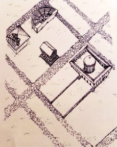
Since the foundation the vastness of the public spaces reserved for the gods and the meeting place of citizenship stands out: the whole central strip of the city, for a width of 300 m and a width of about 900 m, from the Porta Aurea to the north up to the Porta Giustizia to the south, it is destined for the agora square and the two great urban sanctuaries, soon monumentalized, such as the Heraion of the Sele river, through the construction of imposing sacred buildings. Poseidonia together with Metaponto, despite all the urbanistic and chronological uncertainties due to the successive phases of life that have erased most of the oldest settlement fabric, are the best known cases of archaic urban plants, the result of a careful planning of the spaces and their rational distribution. (5)

NOTE: The individual chosen by an ancient Greek polis (town) as the leader of any new colonization


BIBLIOGRAPHY:

  1. Giocacchino Francesco La Torre, Sicilia e Magna Grecia, Editori Laterza, 2011 pp 195-196
  2. Ibidem, 53-54
  3. Ibidem, 89
  4. Ibidem, 53-54
  5. Ibidem, 196


For further info about our Paestum and Buffalo mozzarella farm tour


In the ancient world, the ideal of female beauty derived from a Greek canon, from marble sculpted deities by artists who modeled the best  features of various women to create a virtual, ideal and absolute beauty. This ideal beauty, combined with the hairstyles and clothing of the classical tradition, has always been well represented artistically  in Pompeian painting and sculpture.

A work of art which can be considered a real cultural icon of Greek beauty is the famous “Venus  Anadyomene” (from Greek, “Venus Rising From the Sea”), the goddess of love, depicted in the act of rising from the sea and resting her hands on wet hair. Originally it was created by the famous Greek painter Apelles in the 4th century B.C. for the Asklepeion, the temple dedicated to Asclepius, on Cos,  a Greek island facing Turkey. According to the different versions of the story, either Phryne, the model used by the great artist was a very famous hetaera [ among the Greeks, a courtesan, normally a stranger, free or a slave, elegantly dressed and, in general, rather highly cultured], or Campaspe, lover of Alexander the Great.

The painting was later brought to Rome by Augustus, and placed in the Temple of Venus Genetrix, to evoke the mother of the “gens Iulia” (Strabo 14.2.19). However this masterpiece of Greek art was also very famous in the area of ​​Mount Vesuvius. This is confirmed by an inscription found in Pompeii where the scriptor, the writer, compared his beloved to the Venus of Apelles (CIL IV 6842 = CLE 2057): Si quis non vidi(t) Venerem quam pin[xit Apelles] | pupa mea aspiciat: tali set i[lla nitet].

The wide diffusion of this model is confirmed by the dozens of copies of the Venus  Anadyomene spread among all the social classes of the population, at various artistic levels, from marble and bronze statues, as well as wall frescoes (such as in Pompeii in the House del Prince of Naples – see photo), but it is above all in the decoration on small tools of instrumentum domesticus, in particular on hair pins, where she was represented. Sculpted in bone, they were relatively inexpensive and multi-purpose instruments, widespread even in modest-sized houses, ubiquitous in female beauty care: they served as sharp instruments for applying makeup and also for dividing and styling hair. The hair pins  could remain fixed in the hair to be within easy reach in case of need and were also portable amulets. Such a hair pin, together with an amulet pendant also in the shape of Anadyomene, was found in the house of L. Elvio Severo in Pompeii (1). In addition, the box for ointments and toiletry items in the Imperial house in Pompeii was secured by a bronze padlock in the shape of the same goddess. (2)


BIBLIOGRAPHY:

  1. Berg, “Donne medico a Pompei?”, in A.Buonopane, F. Cenerini (a cura di), “Donna e lavoro nella documentazione epigrafica” , Atti I seminario sulla condizione femminile nella documentazione epigrafica (Bologna, ottobre 2002), Faenza 2003, pp. 131-154
  2. Ria Berg  “Attrarre” – in Massimo Osanna e Carlo Rescigno, “Pompei e i Greci”, Electa 2017, pp. 213-214


For further info about our guided tour of Pompeii

In 1731 King Charles of Bourbon inherited the famous “Farnese collection” from his mother, Elisabetta Farnese. When the enlightened sovereign ascended the throne of Naples in 1734, he took these splendid works of art with him in dowry to the Parthenopean city. Charles furthermore ordered the excavations of Herculaneum (1738) and Pompeii (1748), which led to the discovery of an impressive number of Roman Art treasures.

However it was only in 1777 that Charles’s son, Ferdinand IV of Bourbon, determined by decree to gather these great dynastic collections, (Farnesian, Pompeian and Herculaneum) together in the  “Palazzo dei Vecchi Studi” (the Old University) and earmark them for public use. Moreover, this new building was envisaged as an encyclopedic museum where all human knowledge should be situated: works of art, books, papyri, studios  and even an astronomical observatory. Following the dominant Enlightenment culture, the educational aspect of this museum and its importance as a public utility were emphasized. Consequently,Ferdinand intended to bring together workshops, laboratories, painting, sculpture, and restoration schools and more. It was aimed to create a museum-workshop-school in the building. However, in order to do this, the old “Palazzo degli Studi” required profound changes and, in 1806 when the French arrived, the building was still under restoration.

During the French domination, first Giuseppe Bonaparte, and then Gioacchino Murat, abandoned the museum’s encyclopedic project for nearly 10 years, “reducing” it to a simple venue for the exposition of the imposing Farnese and Bourbon collections.

During  the Napoleonic period, all the leading museums in the territories conquered by the French armies were stripped of their most important masterpieces which were channelled  to the Louvre Museum in Paris. But the Archaeological Museum of Naples (like the Brera Museum in Milan) did not suffer from depletion; in fact it was enriched with famous masterpieces.

Murat sought an autonomous kingdom in Napoleonic Europe. The new director of the Museum, Michele Arditi (1807-1838), immediately showed his worth: first of all he introduced  more severe management of the personnel compared to the previous state of disorder; the obligation and control of daily working hours; respect for a precise work timetable and the prohibition of objects being taken out of the Museum. After the fall of  Murat (1815), during the Bourbon restoration, Ferdinand I again confirmed Michele Arditi as director of this institution which was growing continually.

What clearly made the difference between French and Bourbon management of the Archaeological Museum  was that, with his return, King Ferdinand I explicitly stated that the collections of the Archaeological Museum were his “allodial property” and therefore alienable. The royal sites belonged to the Crown – and were therefore not saleable, – but the collections were property of the king (and therefore privately owned). The idea advanced by the French kings, that artistic masterpieces were  protected by the State, was therefore denied by this declaration of Ferdinand I.

The restored Bourbon monarchy maintained  the original educational and public purpose of the Archaeological Museum of Naples, but at the same time it displayed a mentality not in line with the most modern Enlightenment principles.

Later, only in 1822, would the transfer of the archaeological artifacts from the “Herculaneum Museum” of Portici be completed, but despite all efforts, the Royal Bourbon Museum continued to seem  an overcrowded repository  without any precise exhibition criteria. Infact, the first extensive re-organization only took place during the Unification of Italy under the decisive intervention of Giuseppe Fiorelli.


Excerpt from:  Nadia Barrella e Ludovico Solima, Musei da svelare, Luciano editore, Napoli, 2011, pp. 17-23   

For further info about our guided tour of the National archaeological Museum of Naples


The colonisation process of Southern Italy and Sicily lasted a couple of centuries and began in the 8th century B.C.

The first Achaean colony seems to have been Sybaris, in the middle of an alluvial plain between the mouths of the Crathis (Crati) river and the Coscìle river, the ancient Sybaris. According to Ephorus of Cyme, a Greek historian – c.  400 – 330 B.C. this Achaean city lived for 210 years and was destroyed in 510 B.C. by Kroton.  It can thus be traced back to 720 B.C. for its foundation. Strabo (VI, C 263) reports that oikistes (see Note) of Sybaris was Is who was a native of Elice, unknown city of Achaea in Greece.

The innumerable studies carried out on the proto-historic centres in the area of Sybaris, confirm that the arrival of the Achaeans in that territory and the subsequent foundation of Sybaris represented a strong impact on the indigenous villages.  All the centers of the early Iron Age (IX-VIII centuries B.C.) were destroyed and abandoned at the end of the 8th century B.C.   But as it happened for Syracuse, very probably Sybaris also did not exterminate the indigenous populations that inhabited the district. Many of them were probably enslaved or at least used as labour in the countryside and in the cities.

The Achaean “pòlis” (town) soon succeeded in creating a real empire, its merchants ascended along the rivers that flow into the Ionic Sea, they reached the central Apennine mountains and from there they descended along the rivers flowing into the Tyrrhenian Sea. They created a district totally controlled by Sybaris. Strabo (VI, C 263) described Sybaris as a real “empire” that in the Archaic period (600 B.C. – 480 B.C.), controlled 4 populations and 25 cities.

To understand the precocious territorial growth of this Achaean pòlis (town), it is interesting to consider also what Diodorus reported (XII, 9, 2): he wrote that Sybaris granted its citizenship to foreigners with relative ease.

This vast empire of Sybaris was articulated internally through different gradation, ranging from the direct control of the chòra politikè (territory outside the walls where farmers cultivated the fields and dedicated themselves to agriculture), to formally equal relations with some of the more distant communities. An important inscription found at Olympia, datable to the second half of the 6th century. B.C. preserves elements of fundamental importance that integrate the Strabo’s description. This is a peace treaty signed between Sybaris and their allies (Sýmmachoi) and the Serdàioi, an indigenous community that recent studies tend to place in the “Valle del Noce”, on the border between northern Tyrrhenian Calabria and Lucania. Ultimately the empire of Sybaris, beyond the original chòra, where indigenous people most probably worked as slaves, consisted of a substantial group of subdued communities (probably 4 populations and 25 cities, as Strabo says) and finally in a circle of allies (the Sýmmachoi of the  Olympia treaty), at least formally independent. In the Greek colonial world, this is probably the first example of a complex territorial entity, extended beyond the limited boundaries of traditional pòlis.

Very important were also the extra-urban sanctuaries of Sybaris, real projections of the city in the “chòra”. Through the sacred dimension, they marked the progressive control of this Achaean “pòlis” (town) on the territory and, at the same time, attracted the indigenous populations of the district, also assuming the role of privileged places of contact and exchange in the border areas. Since the time of the foundation, the sacred marked the limits of the “chòra” of Sybaris.        NOTE: The individual chosen by an ancient Greek polis (town) as the leader of any new colonisation.

 Excerpt from: Gioacchino Francesco La Torre, Sicilia e Magna Grecia , Editori Laterza, 2011, pp 84-90


For further info about our guided tours of Pompeii and Herculaneum

The Greek  Sanctuaries can be:

  1. a) Intramural
  2. b) Periurban
  3. c) Extraurban


Their location was linked to methods and needs that varied from city to city and that underwent evolution over time.


Urban and Periurban Sanctuaries:


They were preferably located on the “Acropolis”, citadel built on a high hill, but also in the same “agorài” (main squares), and then along the line of fortifications, to define a sort of “sacred belt”, or, in the case of coastal cities, at the mouth of the rivers, near ports and landings.


Extraurban Sanctuaries:


The “pòlis”, from the moment of its establishment in a foreign land, in addition to carving out a large urban space clearly oversized for the needs of the first comers, subtracted from the natives and also annexed a portion of territory outside the city. This space, functional to finding food resources, was the “chòra politikè”, an essential part, together with the city, of the “polis” political institution. Therefore, exactly as in the mother country, from the beginning the colonial “pòlis” was composed of an inseparable unity between the city (àstu) and that portion of the territory directly subjected to the government of the city (chòra politiké), dotted with sanctuaries from the earliest phase and variously articulated over timeSince the first generations,  the main extra-urban sanctuaries were almost never more than 10-12 km away from the city: it suggests that the size of the most ancient “chòra” allowed farmers however to reach their property (in the “chòra politiké”), to work the land and to return in city ​​over the same day.


Chòra Politiké:


It is clear how the best portion of the “chòra” was divided and assigned to the colonists according to a very well regulated property regime, of which we also have extraordinary testimonies of an economic-juridical or cadastral nature, although much later – the Tables of Eraclea (1), the Tables of the Sanctuary of Zeus Olympios of Locri or the Alesina Table. It is equally clear how at the edge of the divided and assigned countryside there was the “eschatià”, that is a sort of no-man’s land set against the indigenous territories or a neighbouring “pòlis”.

It is important to underline that the limits of the colonial territories towards the wooded areas of the “eschatià” and those inhabited by the indigenous populations were not well defined. Along the coast, on the other hand, especially in the case of (A remove) direct proximity between two neighbouring “pòleis”, the borders had to be established more strictly, so that the historical sources refer to border conflicts, trespassing and raids in the enemy territory, similarly to as documented for the motherland. In these cases the borders were often marked by natural elements, especially rivers, also sometimes marked by the sacred.

The sacred mediated between the Greeks and the indigenous communities of the hinterland, in those very permeable areas, defined as frontiers, in which the meeting of the different cultures became more fruitful and where the interests of the indigenous aristocracies were united with those of the dominant classes of the colonial “pòleis”.


Excerpt  from:  Giocacchino Francesco La Torre, Sicilia e Magna Grecia, Editori Laterza, 2011, pp. 157-160


For further info about our guided tours of Pompeii and Herculaneum

The first Greek colonies founded in Southern Italy and Sicily since the mid-8th century BC were organised according to the “polis model” that developed in the most advanced areas of Greece during the Geometric period (900-700 BC). The sites chosen by the Greek colonists for their settlements were the result of a careful knowledge of the territory derived from decades of frequentation of the Sicilian and peninsular coasts. The settlers analysed carefully the presence of hostile people, environmental conditions and the availability of resources (especially water), and normally they founded their “pòleis” (cities) on the coast. Their cities were founded on islands or islets near the coast (Ischia, Ortigia), on low promontories jutting out on the coast (Naxos, Elòro, Mylai, Taranto), on heights overlooking the sea or sloping (Cuma, Crotone, Caulona, Locri, Megara Iblea, Gela, Selinunte, Himera, Velia), near the mouth of important rivers (Sibari, Crotone, Metaponto, Naxos, Reggio, Selinunte, Gela) or near very well defined natural rivers (Taranto, Messina, Siracusa). Extremely rare were the internal foundations, only a few kilometres away from the sea (Leontini, Agrigento) or many more kilometres (for example Hipponion), and the coastal ones completely flat (Sibari, Metaponto, Poseidonia).
Once the most favorable area was identified and freed from any indigenous occupants, the first settlement could develop without any previous religious or traditional constraint. Therefore this condition allowed to implement a (REAL remove) rational planning of spaces, based on principles of substantial egalitarianism among the first settlers who received plots of land where they could build their dwellings (oikòpeda) and from which their sustenance derived . Thus the definition of the urban space appeared clear from the beginning. The “oikistes”, the guide of the colonists, highlighted the area destined to the city by tracing ritual furrows or by laying terminal stones, subsequently fortified through walls (earth walls and stones) and/or wooden palisades. Then they were replaced by massive walls made of squared and dry juxtaposed stone blocks (generally during the 6th century BC) such as to be immediately distinguishable with respect to the surrounding areas, reserved for the necropolis, all strictly external to the “pomoerium” . This word, borrowing the term from the best-known practices of the Etruscan-Italic and Roman world, came from the classical contraction of the Latin phrase “post moerium”, literally “beyond the wall”: in that religious boundary around the city, nobody could build, live and cultivate.
The settlers, when they founded a city, took into account the prospects for demographic growth and strengthening of the settlement from the outset. In fact, most cities have developed over the centuries within the limits defined at the time of the foundation. Only a few colonial “pòleis” (cities) have recorded over time such a great phenomenon of demographic growth to make necessary enlargements of the urban space: it usually started from the Classical period (480 B.C. – 323 B.C.). The cases of Taranto and Syracuse are emblematic, whose neighborhoods of more recent expansion superimposed on the necropolis of the Archaic period (600 B.C. – 480 B.C.).
Despite the very limited documentation for the first phases of life of the colonies, it is nevertheless evident that the need to immediately distinguish the spaces destined for community practices was primary:

1. Administration of the new “pòlis” (with buildings for the citizens’ assembly)
2. The “agora” (with the offices of the magistrates and where the commercial transactions took place)
3. Sacred areas (used for public cults, dedicated to the protective deities of the community, almost always the same venerated even in the motherland).

Often the “agora” – central public space – stood in the centre of the city, so to be easily accessible, and large enough to accommodate events that involved the entire community, not only of a political-administrative nature, but also religious, military, competitive and ludic.

Excerpt from: Giocacchino Francesco La Torre, Sicilia e Magna Grecia, Editori Laterza, 2011, pp. 157-160


For further info about our guided tours of Pompeii and Herculaneum

It is indeed impressive to note that, twice in the 7th century BC and in the 15th century AD, almost the same region of central Italy, ancient Etruria and modern Tuscany, was the decisive hotbed of Italian civilization.(1)

When in the VIII century BC the Greeks set foot on the coasts of Campania, they found it inhabited by populations who were different in language, customs and level of development, and they immediately established a relationship with them, now conflicting, now more or less friendly. The Greek historians of the Classical Age (480 B.C. – 323 B.C.), more attentive to the events of the Greek pòleis (cities), have  told us little or nothing about these local peoples, who appeared to them barbarous and, therefore, devoid of history. Only two names have been handed down from these various indigenous peoples, the  “Ausoni” and the “Opici”, sometimes assimilating them, more often distinguishing them. The “Ausoni”, of whom the “Aurunci” were considered to be descendants in historical times, lived between the “Liri” and “Volturno” rivers and were considered the first inhabitants of the region.  “Opici”, on the other hand, according to some modern historians, would reflect a later reality, the so-called “Fossakultur” (Culture of Fossa Tombs)  of the final Bronze Age (XI-X century BC) and of the early Iron Age (IX- VIII century BC). Of this period we have scarce archaeological evidence, above all the materials of the pre-ellenic necropolis of Cuma, the grave goods of the necropolis of the Sarno Valley (San Marzano, San Valentino Torio, Striano). On this indigenous substratum the “Villanovan culture” (from the burial ground of Villanova near Bologna which was  first identified by Giovanni Gozzadini in 1853), that practiced  cremation, developed.  It seems that  the “Villanovan culture” evolved a few centuries later directly within the Etruscan culture, which was certainly well distinguished also on the linguistic level by indigenous cultures. (2) It is important to underline that the  “Villanovan Culture”  practiced cremation: in this historical period – with the transition from the Bronze Age to the Iron Age, which began at the beginning of the IX century. B.C. – the first distinction among the different peoples which draws our attention comes from the various funeral rites practiced . (3) Strabo wrote (4): ” The Tyrrhenians had twelve cities in Etruria, twelve of which they founded near the Po river, witness Livio (5), and twelve they founded in “Opicia”, whose capital city was Capua.   (6) Capua is their metropolis, “head” of the others, according to the origin of its name. Since the others in comparison were small castles, except for Teano Sidicino. The Etruscan culture pervaded the entire interior of the Campania region, so that even the most peripheral Italic tribes, such as the Samnites of the interior, ended up assuming behaviors typical of the Etruscans, by considering the expansion of the more typical Etruscan products such as buccheri (typical Etruscan class of ceramics) and bronze objects. On the other hand, the same Greek border colonies such as Cuma and Poseidonia ended up receiving marked Etruscan influences, for example in the adoption of wooden architecture with terracotta decoration with bright colors. (7)


WHY ARE THE ETRUSCANS SO IMPORTANT TO UNDERSTAND THE ROMAN AND POMPEII HISTORY  ?

The study of the Etruscans is fundamental for understanding the Roman world in general and Pompeii in particular. The Etruscan civilization had a profound influence on Roman civilization, later merging with it. The Etruscans were present in Campania from the ninth century, B.C. and it was probably these people who favored the foundation of Pompeii. With their synecism (see Note), they favored aggregation in a single city, Pompeii, of the mythical “Sarrastri”, a people who previously lived scattered in hut villages along the banks of the Sarno river.


NOTE:

Synecism = It was originally the amalgamation of villages in Ancient Greece into pòleis, or city-states

BIBLIOGRAPHY:

  1. Jacques Heurgon, Vita quotidiana degli Etruschi, Editore:IL SAGGIATORE 1967, p. 23.
  2. Stefano de Caro Le culture della Campania antica preromana: gli Etruschi, i popoli italici e le loro città da Il Museo Archeologico Nazionale di Napoli – Electa Napoli 1994 pag. 33
  3. Gioacchino Francesco La Torre, Sicilia e Magna Grecia, Bari, Editori Laterza, 2011, pag 17
  4. Lib. V pag 373
  5. lib. V. C. 33
  6. Ibid.
  7. Stefano de Caro op. cit., p. 34


For further info about our guided tours of Pompeii and Herculaneum

The huts, of varying sizes and often enclosed by a fence, were generally almost rectangular in shape with one of the short apsidal sides, generally open on the long side, with two aisles and a gable roof. Inside each structure there was a hearth, but often a larger oven was also installed externally for production purposes. The settlement of Poggiomarino, in fact, since the most ancient phases of the Iron Age (IX – VIII century BC), was characterized by handicraft activities of metal, bone, glass paste and amber artifacts, taking shape therefore as an important center of production and exchange of prestige goods. Archaeometric analysis on amber allowed us to confirm that this raw material came from other places, beyond the Baltic. For the “Orientalizing period” (VII century BC), a local fusion activity of metals was also ascertained in Poggiomarino, and isotopic analysis (Isotopengéologie Laboratory of the University of Bern) on lead confirmed that this metal was imported both from South-western Sardinia and from southern Spain (Rio-Tinto Huelva and / or Alpujarride region).

Textile activity, of a domestic nature, must have been fundamental for the local community, as numerous loom weights were found for weaving.

The subsistence economy of this community was mainly based on agriculture and livestock, however, in Poggiomarino, hunting and fishing activities are also documented – irrelevant though, from an economic point of view.

Furthermore, we know that the ancient inhabitants of these marshes also collected spontaneous fruits such as hazelnuts, blackberries, carnelians and – as fodder for the breeding of animals – acorns and oak-galls. There was also a cultivation of cereals and legumes (broad beans), as well as the pressing of grapes to produce wine. Numerous grape seeds were found whose morphobiometric study (dr L. Costantini) confirmed their origin from fruits of cultivated vines.

Also the analysis carried out on the faunal remains (animal bones and malacofauna – which is mollusks) have provided very significant information. The bone remains attributed to domestic animals (cattle, sheep and goats and pigs, but also horses and dogs) are predominant compared to those attributed to wild species (deer and wild boar). Livestock breeding therefore played a primary role in the subsistence economy of Poggiomarino, as cattle, sheep and goats and pigs were the main source of meat to which must have been added, albeit modestly, that from wild mammals and birds. Pigs were only bred for meat production while other domestic animals also provided other resources: cattle had great importance in agricultural work and sheep and goats were exploited for wool, and large and small ruminants could supply skins, horns and bones to work, but also milk for dairy production. As for the horses, of rather limited number, it was thought that their meat did not fit into the eating habits of the local people, and they were used as mounts or draft and loading animals. Among the wild animals the deer is the most widely attested above all through the presence of antlers (the branched appendages of the cervids), some of which were worked. Among the birds, there were animals related to the fluvial-marsh environment such as ducks (geese and ducks) and waders. Otters and turtles are also attested in Poggiomarino – portions of carapace (turtle shell) and plastron (ventral bone plate of the turtle shell) were found. The collection of turtles was evidently for food purposes.

The archeomalacological investigations (studies of ancient mollusks through the observation of the shells) have identified the presence of fresh water, continental and marine mollusks. The first two species were probably collected around the site for food purposes while for marine species they apparently came from sandy bottoms of the ancient mouth of the Sarno river. The perforation of a large number of valves and the shaping of anthropogenic origin of some shells attest to their use for ornamental or ritual purposes. The remains of ichthyofauna (the fish life of this region) are scarce, but the discovery “in situ” (on site) of numerous bronze hooks and net weights confirm the activity.

A very interesting datum emerged from the analysis conducted on some samples of pebbles found in very large quantities in Lòngola: they came from Ischia and from Sardinia. The hypothesis has been advanced by G. Di Mais according to which this material would have been used as a ballast for boats that arrived empty at Poggiomarino and would then leave full of cereals from there – during the Iron Age the entire plain of Sarno had wheat and cereals growing on it – or even prestige goods.

The huge amount of wood recovered in the village of Lòngola, above all poles and boards for the reclamation and regimentation of the banks of the canals but also structural elements required xylological analysis (xylology = study of wood): the genus “Quercus” (oak tree) was the most represented , both for the excellent characteristics of resistance and, obviously, for the abundant availability in the areas surrounding the settlement. In Poggiomarino, this species had very wide and well-spaced growth rings, typical of trees grown in a damp plain forest, but there is no lack of oaks with more rings, coming from the nearby mountains. Very significant is also the use of boards made of white fir wood, with good durability, which came from areas quite far from the site; this shows an ability to select the material according to the specific need for use. (1)

NOTE:
Magna Graecia (Megalē Hellas) refers to the coastal areas of Southern Italy which were colonized by various ancient Greek city-states from the 8th to 5th centuries BC

BIBLIOGRAPHY:

1) Caterina Cicirelli, Stato delle ricerche a Longola di Poggiomarino: quadro insediamentale e problematiche, in Pietro Giovanni Guzzo e Maria Paola Guidobaldi, Nuove Ricerche archeologiche nell’area vesuviana (scavi 2003-2006), Atti del Convegno Internazionale, Roma 1-3 febbraio 2007, L’Erma di Bretschneider, 2008, pp. 476-480


For further info about our guided tours of Pompeii


Cuma, the first “apoikìa” [from the verb “apoikèo” = “I live far away”] – Greek colony of the West, immediately after its foundation in the second half of the 8th century BC , expanded rapidly along the coast of the Gulf of Naples, founding fortress-ports, “epìneia”, such as Miseno, Pozzuoli, Pizzofalcone, Capri. It was a way to guard the territory and control it.

However, at the end of the 6th century B.C. Cuma also favoured the foundation of “Neapolis” (1), which was not only an emporium like many others, but a real city: this further expansion inevitably led to a clash with the Etruscans, another population which spread across the territory. From their cities in the Campania plain (Capua, Calatia, Nola) and the Salerno area (Pontecagnano, Fratte) they moved towards the coast contending with the Greeks the dominion over the indigenous people. (2) The naval battle of Cuma of 474 B.C. was won by the Greeks and it caused the beginning of the progressive decline of the Etruscans in Campania.

Although very little of the Greek-Roman “Neapolis” remains today, the historical center of Naples, entirely superimposed on the ancient city, has maintained its regular urban planning, articulated on 3 East-West “platèiai” [sing. platèia – main roads] and about twenty North-South “stenòpoi” [sing. stenòpos – secondary roads], forming rectangular blocks (35m x 160/180m). The city developed over about 70 hectares and was surrounded by gullies. It was also bordered by massive city walls of tufa blocks dating back to the 5th century BC, restored several times between the 4th century B.C. and the 5th century A.D. (3)

The very large “Agorà” [main square], was divided into two levels, separated by the median “platèia”, traced by the current “Via dei Tribunali”. This arrangement is known above all for the presence of remains of buildings from the Roman era, although it is a shared opinion that it may reflect a contemporary urban planning of the Greek Hippodamian style.
The upper agora, the mountain area, is characterized by the presence, of two big buildings for show side by side, the Theater and the Odèion (Small Theater). To the south is the great “Dioscuri” temple, also from the Imperial era, which dominated the median “platèia”. (4) Of this temple, two surviving Corinthian columns are still on the facade of the “Basilica of San Paolo Maggiore” in Naples.
The lower agora, however, narrower than the upper one, boasted the presence of the covered market and the shops of the Imperial era. The functional distinction between the two squares, which appeared evident in the Roman era, may have been realized as early as the 4th century BC, when the lower agorà assumed a commercial character, leaving the more purely political functions to the upper one. (5)


WHY IS THE HISTORICAL CENTER OF NAPLES SO INTERESTING ?

The historic center of Naples, entirely superimposed on the ancient Greek city, has perfectly preserved the regular urban planning of the Greek “Neapolis”, divided into 3 East-West platèiai (main roads) and about twenty North-South stenòpoi (secondary roads). The Greek city and, at a lesser depth, the Roman city are well preserved under the streets of the current historic center: in archaeological areas such as the excavations of the church of San Lorenzo, this phenomenon is very evident.

Furthermore, it seems that Akragas (Agrigento), in Sicily, was the only city of the colonial West to have developed duplication of the space destined to the ”Agorà” (main square) already in the classical era [480 B.C. – 323 B.C.], with a radical separation of administrative functions from commercial ones, according to a scheme which, in the motherland, took place in the late classical and Hellenistic period. (6). However, it seems that “Neapolis” soon followed the example of the illustrious polis (city) of Akragas, and this aspect is particularly interesting.


Bibliography:

1) See article: Daniela GIAMPAOLA, “Approdare”, pag 207, in Massimo OSANNA e Carlo RESCIGNO – Pompei e i Greci , Electa 2017
2) Stefano DE CARO “Le culture della Campania antica preromana: I I Greci (Pithekoussai, Cuma, Neapolis) in “Il Museo Archeologico Nazionale di Napoli” – a cura di Stefano De Caro – Electa Napoli 1994. pag. 21
3) Gioacchino Francesco LA TORRE, Sicilia e Magna Grecia –– Editori Laterza – 2011 pag.210
4) Ivi, pag 260-261
5) Ivi, pag. 261
6) Ivi, pp. 258-260


For further info about our guided tours of Pompeii


Museums cost a lot of money, because they require qualified personnel, constant maintenance of the spaces, conservation and restoration of the artifacts, microclimatic control of the exhibition halls and repository, security systems, and so on. However, a museum (or an archaeological site) must be financed by the community because only in this way can it  carry out its “public service” of education, study and enjoyment (1) in a complete way and without external influences. On the other hand, the fact that a museum is “financed by the community” is also a litmus paper of the degree of civilization of a Country and its political maturity.


If the museum were to self-finance like any private company, that is, trying to be more and more appreciated by its customers/visitors, it would be forced to perform only (or above all) those activities of sure success for its visitors. But the orientation of the museum towards the visitors, if based on the satisfaction of their  needs as they result from the analysis of customer satisfaction, would reduce its capacity for experimentation and innovation.  Egyptian antiquities, the Impressionists and dinosaurs are themes of sure success, but the more exhibitions on these subjects are displayed, the more their contents tend to repeat themselves. So even if these exhibitions bring more public to the museum, that audience from that museum does not draw significant cultural content. (2) Therefore, the museum must be funded by the community.

The Great Paradox:

This institution has been called the “museum/rentier” because it lives on public funding, like the landowner who does not work, but merely manages his own income. The “museum-rentier”, being able to count on financial sources not directly related to the cultural activities carried out, lives – most of the time – a life coldly detached from the demand expressed by citizens, responding exclusively to those who provide the flow of public funding, the Public Administration.  The museum does not need to find sources of support by implementing a strategy of relationships “services offered/financing” with the different components of society (citizens, tourists, foundations and non-profit institutions, commercial operators, companies, business associations, public and private bodies, local authorities, etc.). So here is the paradox that the public functioning of the museum – which is born and justified to favour the use of the public service/museum by all citizens – risks distancing  from them rather than  drawing them in. (3)


BIBLIOGRAPHY:

(1)  ICOM (International Council of Museums) defines the museum as follows:

 It is an organization that was created in 1946 by and for museum professionals. A museum is a non-profit, permanent institution in the service of society and its development, open to the public, which acquires, conserves, researches, communicates and exhibits the tangible and intangible heritage of humanity and its environment for the purposes of education, study and enjoyment.

2) Maria Vittoria Marini Clarelli, Il Museo nel mondo contemporaneo, Carocci Editore, 2014, pag. 82

3) ibid. pp. 53-54


For further info about our guided tours of Pompeii